Anstey Hill
Distance: 3.1km
Metres Climbed: 187
Avg Gradient: 6%
Road Quality: Pretty good
Traffic: A fair bit during peak hours, but mostly ok. I’ve only done this one on a bunch ride with 200 other people, so this is second hand info
Strava: http://www.strava.com/segments/670397
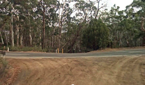
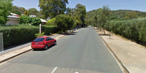
Anstey Hill starts near the top of Lower North East Road, at the roundabout-intersection with Grand Junction Road. The climb is pretty steady, with the first part and the third quarter being the hardest, and easing off towards the end. To get there from Adelaide takes about 12km along Lower North East Road, which is fairly unpleasant, which makes this hill a less popular way to access the hills. That said, it does open up onto some lovely rolling roads, which make the effort worth while.
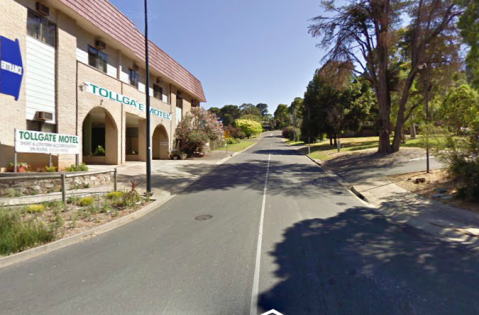
The strava segment for the climb starts on Lower North East Road, just as you pass Perserverance Road
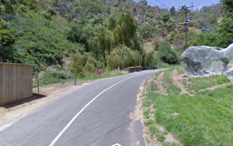
The road goes straight up for a couple of hundred metres before you swing left, and start to get views over the city and countryside. The first half of the climb tracks around the side of the hill, and on the left is Anstey Hill Recreation Park. About half way up the road switches sides of the hill, and you spend about 700m going up a little more sharply – around 7-8% before the road flattens off to around 4% in the last 500m to the finish. The climb ends at the intersection with Range Road.
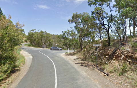
From the end of the climb you can take either Range Road or continue along Lower North East Road until you meet North east Road, or you can turn right a couple of hundred metres along onto Paracombe Road. Following North East Road further into the hills gives you some great views and decent riding – so long as you don’t do it during busy times of day. Eventually you’ll meet the top of Gorge Road, or you can continue on to Gumeracha.
Sprigg Road
Distance: 2.7km
Metres Climbed: 158
Avg Gradient: 5.6%
Road Quality: Good bitumen for the first half, then pretty rough/corrugated dirt for the second part
Traffic: Very Low, particularly on the dirt section. You might see a car on the bottom half, but probably not.
Strava: http://www.strava.com/segments/3244241
I’ve been riding a fair bit of dirt lately, there’s something about skitting about on thin tires that is really fun. Anyway, my latest offering is Sprigg Road, which connects Piccadilly Road and Mt Lofty Summit Road. This is a pretty easy climb, and also pretty beautiful. There are a couple of pinches over 10%, but mostly the road undulates it’s way up the side of the hill. Turn onto Sprigg Road from Piccadilly Road, and then start the climb when you reach the intersection with Lampert Road.
From here, the first half of the climb is pretty straightforwards. You’ll find yourself riding through perfectly manicured hobby-farms and vineyards, before entering into a eucalyptus forest. As you pass Ross Road to your right, you’ll go up a pretty steep section for 2-300m, hitting around 14%. After that it flattens out again, until you near the intersection with Gores Road.
From here, the road turns to dirt, and the average gradient becomes steeper. Whilst still undulating, the average is more like 7-8%, which coupled with the dirt can pose a challenge. I suggest turning over a slightly bigger gear than your normally would, and staying seated. This way you’ll maintain the maximum amount of traction. Sitting down is more important than a big gear, so change down before you stand up. There are some corrugations on the road around the inside of most of the corners, which you can either avoid or ride straight over. The climb finishes when you intersect with Mt Lofty Summit Road
From here you can turn left to go on up to the summit, or right to head towards the top of Greenhill Road.
Blockers Road
Distance: 4.0km
Metres Climbed: 223
Avg Gradient: 5.5%
Road Quality: Dirt, mostly fairly well packed, but somewhat rutted and corrugated in areas
Traffic: Local traffic only, don’t be surprised if you’re passed once, do be surprised if you’re passed twice.
Strava: http://www.strava.com/segments/973562
Blockers Road, starting in Basket Range, and ending in Forest Range is not particularly well known, and is quite a challenging climb. The first 600m or so are sealed, but most of the way you’ll be riding on dirt. I did it on 23mm tires, and was fine, but it would be more comfortable, and quicker on something a little wider, with a bit more traction. Starting at the intersection of Blockers, Merchants, and Wyes Road, you’ll jump straight into the first part of the climb, at about 8 or 9 %.
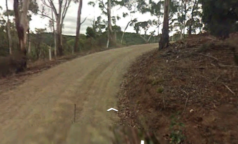
The first two thirds of the climb are really pretty easy. There are a couple of points at maybe 10%, but there are also a lot of flats, and some descents. All of this is made up for by the last third. Your first warning is a little rise, maybe 20m long at about 18%. Then, once you get past that, you’ll go round a decently sharp right-hander.
It’s not much to look at in the photo, but you’re looking at 18-19% on the outside of the corner, or something ridiculous on the inside. Unless you’re Philippe Gilbert and you’re launching an attack on the field, just don’t even go there.
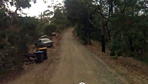
Once you’re around the corner, the gradient levels out for a bit, as you ride along the ridge for a few hundred metres. Soon enough you’ll reach a collection of old Peugot’s. The cars, that is. There’s little to explain this, but they signify the start of the final ramp.
From here it’s pretty much 500m of pain. The last 600m average over 12%, but that hides the fact that you’ll hit 25%, and spend most of your time at around 20%. Being on gravel, you won’t be able to stand up easily without losing traction, so it’s pretty much a case of sitting down and grinding away.
You finish the climbing at the intersection with Mawsons Road, and turn right to go to Forest Range, at the intersection of Lobethal Road and Deviation Road, or left to explore more dirt on the way to Lenswood.
Range Road
Distance: 2.1km
Metres Climbed: 88
Avg Gradient: 4.3%
Road Quality: Average
Traffic: Light, often fairly fast
Strava: http://app.strava.com/segments/1780462
Not a mighty hill in it’s own right, Range road is one of a number of connectors from Lobethal Road to Greenhill Road. It’s also a fantastic option if you’ve just climbed up Little Italy, to combine into one longer, more challenging climb. There is a significant downhill segment near the end of the climb, so the average gradient is a little misleading. It’s probably closer to 6%. Start at Lobethal Road, at the five way intersection in Basket Range. Range road is easy to find – it’s the one that ramps up steeply.
This doesn’t really set the scene for the climb though. Once you get round the corner, it levels out pretty quickly back to 6%. After a couple of hundred metres there’s a dip, which very briefly goes downwards, and then you’re back to about 6% until you reach the Cricket Oval. You’re pretty exposed for the middle part of the climb, but the payoff is that you get great views over Ashton and Mt Lofty to the right, and Basket Range to the left. As you pass the oval, you’ll have a pretty easy 4% for a while, before a short ramp at about 8-9%. Then, you go downhill quite quickly, and you can see the final wall ahead of you.
Keep up as much speed as you can get from the downhill, because this last section is steep. As you go round the corner, you’ll hit 20%, and if you don’t have any momentum left, you’ll feel it. That said, it’s pretty short, and then the last couple of hundred metres are pretty relaxed. The climb ends at the intersection with Basket Range road.
You’d think they could have been more creative in street naming, huh. Going left will take you back down to Lobethal Road, Right to Greenhill Road in Uraidla, and straight on to Greenhill Road without going down the hill. Left then right will take you to Nicholls Road, which is a rather nasty short climb, so that’s an option too.
Gill Terrace
Distance: 500m
Metres Climbed: 64
Avg Gradient: 12.8%
Road Surface: Good
Traffic: Minimal
Strava: http://app.strava.com/segments/1401376
Gill Terrace is a good option to take if you’ve descended the freeway, but want to do just a little more climbing before going home, or alternatively, if you want to warm up before tackling Mt Osmond. At just 500m it’s over before you know it, but at an average of almost 13%, it’s nothing to be sniffed at. Start just below the bike path, on the freeway.
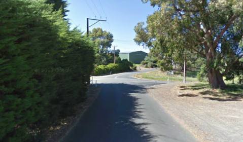
The first 150m, up to the corner at the top of the photo, are pretty easy – an average of about 6%. Then, as you go round the corner, you’re greeted by a wall. For the next 150m the average is about 16%, and there are spots where you’ll touch 20%. Of course, it’s only 150m, so charge away. After that, the gradient eases to about 13-14% for the final 200m of climbing. The segment ends at the switchback, and whilst it looks like the road keeps going up, you’ll find it surprisingly easy once you’ve gone round the corner.
Looking around on the internet, it turns out you can keep climbing a little way along what looks like a driveway – it’s technically still a road, so I’ll go an do that soon, and then update this post. Once you go around the bend, Gill Tce turns into Sunnyside, and you can ride accross the top of Beaumont towards Mt Osmond. When you reach a roundabout, go straight through, and turn right onto Sherwood Terrace to get onto the climb just as it turns nice, or go down a little further and turn onto Thirkell to start Mt Osmond properly.
Fernhurst Road
Distance: 2.1km
Metres Climbed: 230
Avg Gradient: 10.8%
Road Surface: Average
Traffic: Almost None
Strava: http://app.strava.com/segments/677578
I used to go to primary school the next village over from Cherryville, and we used to make jokes about the place. They took a little bit of Tasmania and stuck it in the Adelaide Hills, there’s one road into Cherryville, but no roads out. That sort of thing. In these jokes was a little bit of truth, but when you’re talking about cycling, this makes for something fantastic. Fernhurst Road is, of course, the one road into Cherryville, and if you’re not feeling good, it probably isn’t a way out. As you go down into the valley, the road gets windier, and narrower, and the whole way down it’s shockingly steep. Then, at the bottom, the road ends at a sign saying Private Property, no Entry. So the only choice is to turn around and climb back out.
The thing about Fernhurst is that it’s relentless. After the first hundred metres or so, you go straight into about 500m of roughly 13%. Then, you get a brief rest at about 7% for a couple of hundred metres, before jumping back up to 12% for the next 800m as you go around the sharpest switchback.
You’ll go around another corner, with lots of signs saying ‘go slowly, dust problems’ or something, and the road levels out a bit – back down to 5%, before settling briefly at 10%. Here you’ll pass Old Road, on your left. If you’re feeling wasted, and your bike can handle the dirt, this provides a bail-out option, but seeing as you’re 2/3 of the way up the hill now, my advice is push on through.
Of course, you’ll still have to climb up the steepest section in the whole climb – about 300m at an average of 14%. The steepest gradient you’ll hit here is just over 16%, and that’s the hardest part of the climb. After that, it finally settles back down to almost flat, and you’ll have reached the top of the hill.
Turn right to descend Montacute Road, or left to head towards Ashton, Norton Summit, and Mt Lofty. Whilst this may not be the steepest climb in town, and there are brief sections about which are much harder, they’re all far shorter. The way this climb just stays steep for the whole two kilometres means that it’s one of the most challenging climbs in the hills. That said, it’s also one of the most satisfying!
Tilleys Hill Road
Distance: 1.8km
Metres Climbed: 147
Avg Gradient: 8.1%
Road Surface: Awful
Strava: http://app.strava.com/segments/764510
Turn off Brownhill Creek Road https://adelaidehillclimbs.wordpress.com/2013/05/30/brown-hill-creek/ about half way up, and you’ll cross a small ford, and start climbing up a particularly nasty one-way hill. An average of 8% doesn’t really convey how hard this climb is, The first 900m average 11%, with a couple of sustained sections over 15%. Even worse, the road is incredibly rough. About as rough as it gets whilst still being tarmac. I imagine that somebody paved it forty or fifty years ago, and then seeing as only a couple of people live on the road, nobody every thought about it again.
The streetview cars didn’t even go up Brownhill Creek, let alone Tilleys Hill, which is a pity, because it’s very pretty. I suppose you’ll just have to go and climb it yourself.
Anyway, on to the second part of the climb. Once you’ve covered the first kilometre, life gets a lot easier, even if the road gets rougher. There’s a brief dip, and then the last 600m or so are comparatively easy – at about 7%.
This climb ends at a dead end, so you’ll have to turn around and go back down the hill, which can be a little hairy. I was getting muscle cramp in my hands keeping myself to 30kph with brand new brakes.
Brown Hill Creek
Distance: 4.4km
Metres Climbed: 118
Avg Gradient: 2.5%
Road Quality: Excellent, then Mediocre
Strava: http://app.strava.com/segments/2649493
This Climb is very similar to Waterfall Gully https://adelaidehillclimbs.wordpress.com/2013/05/15/waterfall-gully/ and Aldgate Valley Road https://adelaidehillclimbs.wordpress.com/2013/05/01/aldgate-valley-road/ in that whilst it’s not very steep, you need to work hard if you want to go fast, and it’s very scenic. The climb can be divided into two parts – the first part has a near-mint condition road, and is an absolute breeze to ride on. The second part, the final kilometre and a half, is pretty rough and bumpy, and is like climbing along a narrow laneway.
To start, turn off Old Belair Rd, onto High Street, and then immediately onto Brownhill Creek Road
Unfortunately, the streetview cars didn’t go up the road, being a dead end, but here’s the start of the climb. The first three kilometres are fantastically smooth, slightly uphill, with a couple of dips, and a couple of slightly steeper parts. For all of this, the average is about 2%, and it never really gets difficult.
Once you pass the turn off to Tilleys Hill Road the second part of the climb begins. This is a little bit more difficult – averaging about 3%, and the road is far rougher.
After a while you’ll pass a couple of signs saying ‘last turnaround spot’ and ‘local traffic only’. Keep on going, the road narrows a little, and basically becomes a single lane. You’ll finish the climb at a dead end, with a turnaround space. I suppose the sign earlier was lying. The only option here is to turn around and go back down the hill, but I suggest you turn onto Tilleys Hill Road on the way back, for a far more challenging climb.
Sheoak Road
Distance: 5.2km
Metres Climbed: 244
Avg Gradient: 4.7%
Road Surface: Variable
Strava: http://app.strava.com/segments/3688478
The Fearsome Sheoak Road. Doesn’t look so bad if you consider the stats above. That’s just because a good section of the climb is covered in 500m – at an average of 15%. Near the start of the climb, this ramp maxes out at 23% – making it one of the steepest sections in town. However, other than this really nasty pinch, the rest of the climb is quite enjoyable.
There’s not all that much traffic, because it’s quite a slow road – there are lots of man-made pinch points, where only one car can pass at a time. To start the ride, turn onto Sheoak Road from Upper Sturt Road/James road, or if you’re coming from that direction, off Belair road.
For about a kilometre, you’ll ride along a pretty flat, pretty straight road. It even goes down hill a little bit. I reckon it’s to lull you into a false sense of security. Don’t start to worry until you make a slight left hand turn, you’ll see the road rising up in front of you, and a sign “20%”
It’s time to enter the pain cave. Fortunately, it’s just 500m long. Unfortunately, this is up there with the most challenging 500m in the state. Once the road (finally) levels out again, you’ve still got some climbing to do, but it’s mostly pretty easy. You’ve got a couple of undulations, where you go down hill for a little bit, and then climb at about 13-14% for a couple of hundred metres. After this, it levels out to about 3% for the next kilometre and a half. Then you go up at 12% again, drop down a bit, and have one final climb up to the top of the hill. This one is about 300m long at about 14-15%, so hard enough, but nothing much compared to what you’ve already done.
You’re finished climbing at the intersection with Upper Sturt Road
Keep going to the left to reach Crafers and Mt Lofty, or right to go back to Belair. To do a real hard hill climb, start this ride by going up Old Belair https://adelaidehillclimbs.wordpress.com/2013/05/01/old-belair-road/ and finish it by going up to the top of mt lofty.
Waterfall Gully
Distance: 3.8km
Metres Gained: 101
Avg Gradient: 2.6%
Road Quality: Average
Strava: http://app.strava.com/segments/703057
A bit like Aldgate Valley Road https://adelaidehillclimbs.wordpress.com/2013/05/01/aldgate-valley-road/ this one isn’t a particularly steep hill. The road is pretty narrow, and there’s some traffic – mostly people driving up to the top of the gully so that they can walk to Mt Lofty. This is a good hill for efforts though – it’s consistent, and lets you push a pretty big gear if need be. To Start the climb, Turn left off Glynburn Road onto Waterfall Terrace, and then immediately right. It’s pretty well signed.
The climb is really quite steady the whole way up. The first 500m or so are a little easier, at maybe 2%, and then there’s one trickier bit, which briefly hits 7%, followed by a short downhill. From then on it’s pretty much 2.5-3% the whole way up. You’ll pass Chambers Gully Road, which is unfortunately blocked off, at about half way, and you reach the end when you go through the gates to the carpark.
That’s pretty much it. An easy little climb in between Greenhill Road and Mt Osmond. It’s very pretty, and getting a good time is quite hard, but if you just want to tootle, it’s an excellent choice. Similarly, if you need something to turn the legs over, between harder climbs, this is a good one.


